University of Toronto HSI-301 Dataset
University of Toronto Hyperspectral-301 (UT-HSI-301) dataset consists of three 301-channel hyperspectral images covering (1) suburban, (2) urban, and (3) forest landtypes. The dataset is collected and pre-processed by the Remote Sensing and Spatial Ecosystem Modeling Laboratory (RSSEM Lab) at the Department of Geography, Geomatics and Environment, University of Toronto, Mississauage.
Suburban
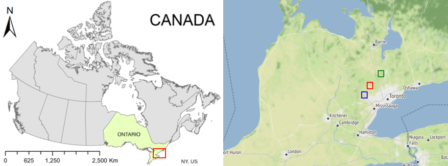
Hyperspectral image collected in an urban-rural transitional area. We refer to this image as “Suburban” dataset. It was captured around Bolton area in southern Ontario and covers an area between 43 deg 52min 32sec and 43deg 53 min 04sec in latitude and -79deg 44min 15sec and -79deg 43min 34sec in longitude. This region consists of various land cover types, such as rooftops, asphalt roads, swimming pools, ponds, grassland, shrubs, urban forest, etc. The image also contains regions that are in shadows. The image resolution is 0.3 square meters and the covered area is around 41182 square meters.
Urban
Hyperspectral image collected in a residential urban area, also around Bolton region in southern Ontario. We refer to this image as “Urban” dataset. It contains rooftops, under construction residences, roads, and lawns landcover types. The dataset also exhibits regions that are in shadows. This image covers the area between 43deg 45min 30sec and 43deg 45min 43sec in latitude and -79deg 50min 06sec and -79deg 49min 51sec in longitude. The image resolution is 0.3 square meters and the area after removing background pixels is around 59834 square meters.
Forest
Hyperspectral dataset collected in a natural forest located at a biological site of the University of Toronto in King City region in southern Ontario. We refer to this dataset as “Forest” dataset. It covers the area between 44deg 01min 58sec and 44deg 02min 04sec in latitude and -79deg 32min 06sec and -79deg 31min 55sec in longitude. The image resolution is 0.3 square meters and the area after removing background pixels is around 43.084 square meters.
Ground truth
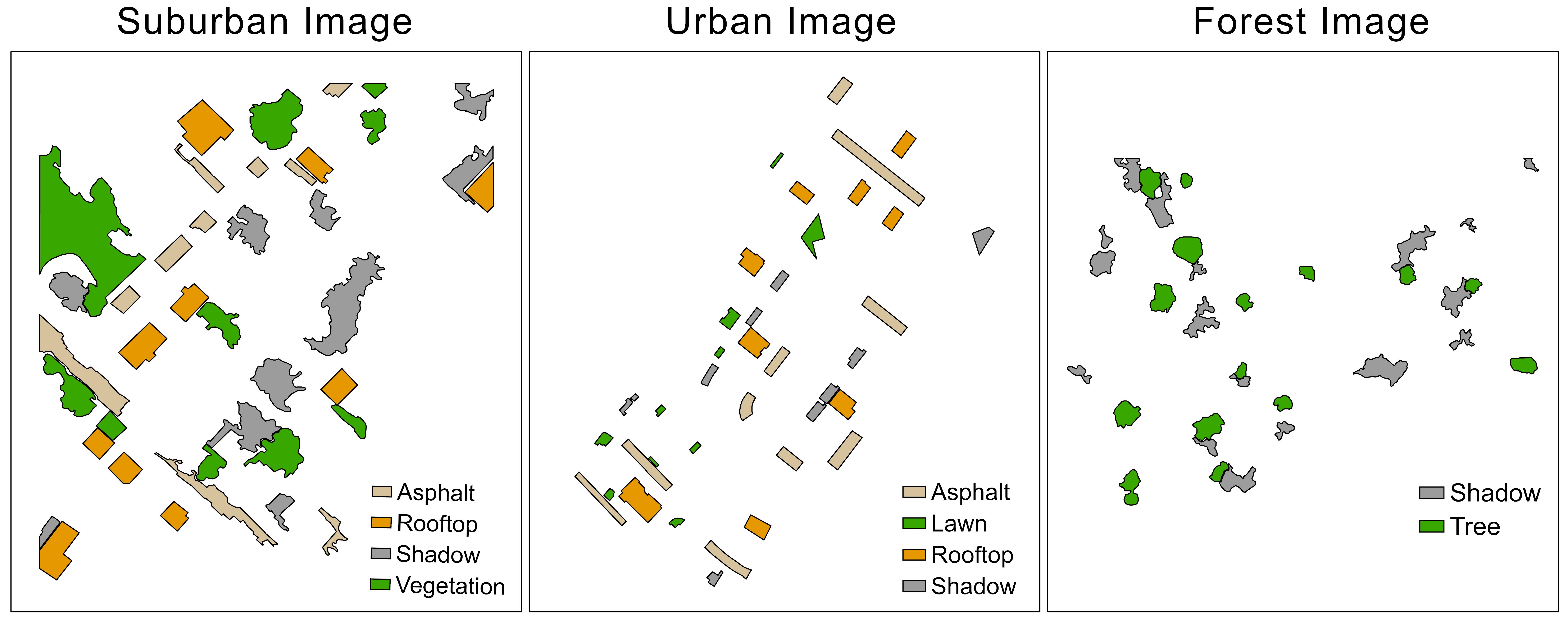
Reference polygons for classification model training and accuracy assessment are manually digitized on the corresponding 0.3-m resolution true-color images. For the suburban image, there are a total of 40 reference polygons of Asphalt, Rooftop, Shadow, and Vegetation, with an equal number of 10 polygons in each class. Similarly, the urban image has 40 reference polygons of Asphalt, Lawn, Rooftop, and Shadow, with 10 polygons in each class. For the forest image, there are a total of 32 reference polygons with 17 polygons of Shadow and 15 polygons of Tree class.
Polygon shape files are available here.
License

This
work is licensed under a
Creative
Commons Attribution 4.0 International License.
Publications
Please cite the following publications if you use this dataset.